Home › Cities › Axim

Old photos of Axim

8 photographs of Axim, from 1880 to 2025 — each pinned to the exact place it was taken.
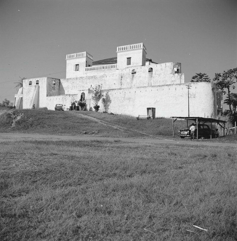
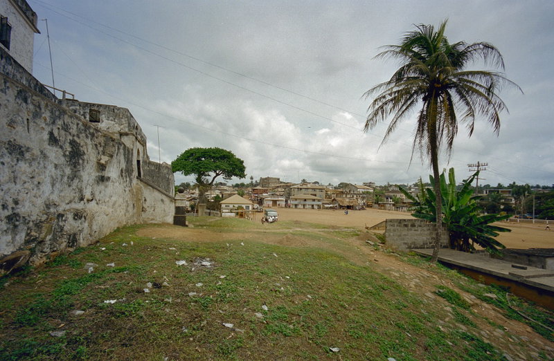
COLLECTIE TROPENMUSEUM Het Fort St. Anthony te Axim TMnr in 1966 — Fort St. Antonio, overzicht - - RCE 1966 COLLECTIE TROPENMUSEUM Het Fort St. Anthony te Axim TMnr in 2000 — Overzicht gedeelte buitenmuur aan de voorgevel met zicht op de stad - Axim - - RCE 2000
Then and now: COLLECTIE TROPENMUSEUM Het Fort St. Anthony te Axim TMnr, 1966 vs 2000
Have an old photo of Axim? A family album, a postcard, a print from the attic. Pin it to the map and it becomes part of the record.
Add your photo

What the photos show

The 8 photographs of Axim on PlaceWas span 5 decades, from 1880 to 2025. 2 of them were taken before 1980; the other 6 are recent views of the same streets and landmarks.3 spots were photographed more than once, so you can compare the same street, square or building across the years.8 of the photos carry a written caption explaining what is in the frame. Every picture is pinned to the place it was taken, so the map below shows where the photographers stood.

Pick a decade to filter the photos below and the map above. Open full map ↗

Places in Axim through time

Spots photographed more than once — compare the same place across the years.
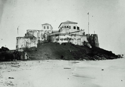
COLLECTIE TROPENMUSEUM Het Fort St. Anthony te Axim TMnr, Axim — photos through time
COLLECTIE TROPENMUSEUM Het Fort St. Anthony te Axim TMnr 3 photos · 1880–2000
A fishing boat comes home, Axim — photos through time
A fishing boat comes home 2 photos · 2025
Fort Saint Anthony, Axim — photos through time
Fort Saint Anthony 2 photos · 2014–2020

Stories from Axim

What contributors wrote about these photographs.
COLLECTIE TROPENMUSEUM Het Fort St. Anthony te Axim TMnr, Axim, 1880
COLLECTIE TROPENMUSEUM Het Fort St. Anthony te Axim TMnr 1880 Fort St. Anthony in Axim, a Portuguese fortification dating to the early sixteenth century on Ghana's western coast, photographed in 1880 during the era of Dutch and later British control of the Gold Coast.
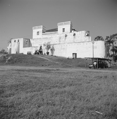
Fort St. Antonio, overzicht - - RCE, Axim, 1966
Fort St. Antonio, overzicht - - RCE 1966 An overview of Fort St. Anthony in Axim, Ghana, photographed in 1966. Built by Portuguese traders in 1515, it is among the oldest surviving European structures in sub-Saharan Africa and later passed to Dutch and British…
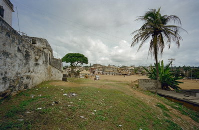
Overzicht gedeelte buitenmuur aan de voorgevel met zicht op de stad - Axim - - RCE, Axim, 2000
Overzicht gedeelte buitenmuur aan de voorgevel met zicht op de stad - Axim - - RCE 2000 The outer wall of Fort St. Anthony in Axim, photographed in 2000, with the modern town visible beyond the old Portuguese fortification that has stood on this stretch of the Gold Coast since the early 1500s.
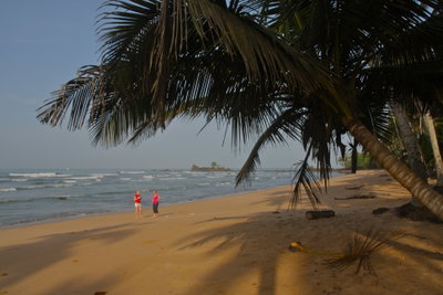
Ankobra Beach, Axim, 2009
Ankobra Beach 2009 This 2009 photograph shows Ankobra Beach near Axim, a coastal town in Ghana's Western Region on the Atlantic shoreline of West Africa.
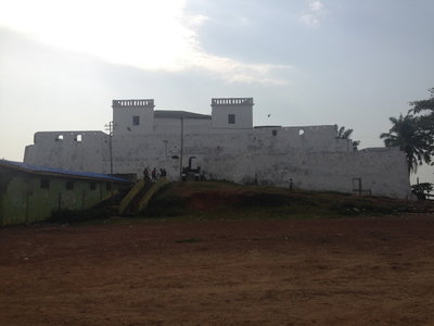
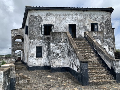
Fort Saint Anthony, Axim, 2014
Fort Saint Anthony 2014 Fort Saint Anthony overlooks the coastal town of Axim in western Ghana. Built by the Portuguese in the early sixteenth century and later held by the Dutch, it is among the oldest surviving European fortifications on…
Fort Saint Anthony - Axim Castle, Axim, 2020
Fort Saint Anthony - Axim Castle 2020 Fort Saint Anthony in Axim, Ghana, seen here in a 2020 photograph, was built by the Portuguese in the early sixteenth century and later passed to Dutch control, making it one of the oldest surviving European-built…
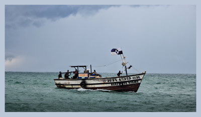
A fishing boat comes home, Axim, 2025
A fishing boat comes home 2025 A fishing boat returns to shore at Axim, a coastal town in Ghana's Western Region long associated with the fishing trade, photographed in 2025.
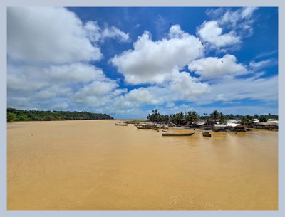
Polluted River against a clear sky, Axim, 2025
Polluted River against a clear sky 2025 A polluted river near Axim, a fishing town on Ghana's western coast, photographed in 2025 under a clear sky.
1880s · 1 photo
1960s · 1 photo
2000s · 2 photos
2010s · 1 photo
2020s · 3 photos