Home › Bukittinggi › Istana Bung Hatta

Istana Bung Hatta through time

Bukittinggi 1859–2018 11 photos of this spot

11 photographs taken at the same spot in Bukittinggi, spanning 1859–2018 — 8 of them from before 1980. Line them up and watch the place change.

A rice storage building stands near Fort de Kock in this 1859 photograph, taken in the Dutch colonial garrison town in the West Sumatran highlands now known as Bukittinggi, a strategic post established by the Dutch during their expansion into the interior.

See this spot on the map
Have an old photo of Istana Bung Hatta? A family album, a postcard, a print from the attic. Pin it to the map and it becomes part of the record.
Add your photo
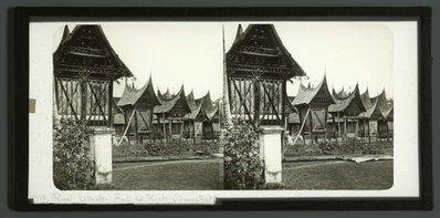
EU: Rice Stocks House Fort de Kock (Sumatra) (1859), Bukittinggi, 1859
EU: Rice Stocks House Fort de Kock (Sumatra) (1859) 1859 A rice storage building stands near Fort de Kock in this 1859 photograph, taken in the Dutch colonial garrison town in the West Sumatran highlands now known as Bukittinggi, a strategic post established by the Dutch during their expansion into the interior.
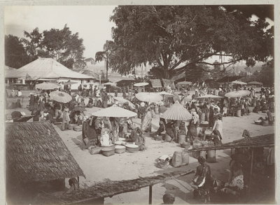
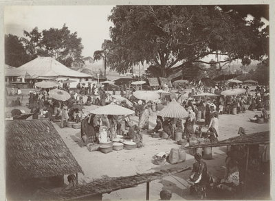
EU: Een pasar in Bukattringgi op Sumatra (1900), Bukittinggi, 1900
EU: Een pasar in Bukattringgi op Sumatra (1900) 1900 A pasar, or traditional market, operates in Bukittinggi, a hill town in the highlands of west Sumatra known as a regional trading center, photographed in 1900.
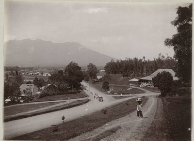
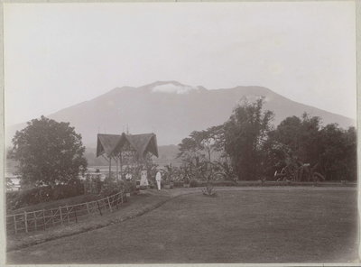
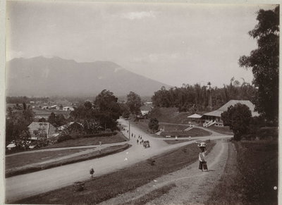
EU: Overzicht van de stad Bukittinggi op west Sumatra met op de achtergrond de Merapi. (1900), Bukittinggi, 1900
EU: Overzicht van de stad Bukittinggi op west Sumatra met op de achtergrond de Merapi. (1900) 1900 An overview of Bukittinggi in west Sumatra shows the highland town spread below the slopes of Mount Merapi, an active volcano, in this 1900 photograph.
EU: Stormpark Fort de Kock (1901), Bukittinggi, 1901
EU: Stormpark Fort de Kock (1901) 1901 The Storm Park adjoining Fort de Kock, the Dutch colonial fortification in Bukittinggi on Sumatra, photographed in 1901.
EU: Een pasar in Bukattringgi op Sumatra (1901), Bukittinggi, 1901
EU: Een pasar in Bukattringgi op Sumatra (1901) 1901 A pasar, or traditional market, in Bukittinggi on Sumatra, photographed in 1901 during the Dutch East Indies era.
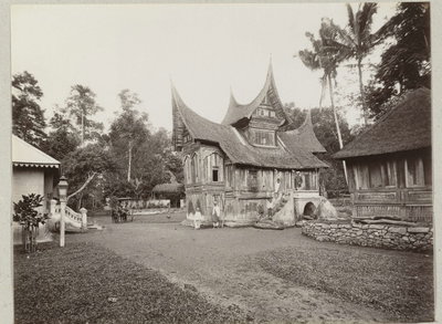
EU: Een Minangkabau woning in Bukittinggi (1901), Bukittinggi, 1901
EU: Een Minangkabau woning in Bukittinggi (1901) 1901 A traditional Minangkabau dwelling in Bukittinggi, photographed in 1901, showing the curved, horn-shaped roofline characteristic of the ethnic Minangkabau people of highland Sumatra.
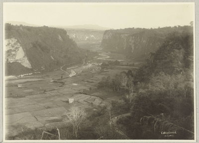
EU: Zicht op het Karbouwengat en de directe omgeving bij Bukittinggi (1901), Bukittinggi, 1901
EU: Zicht op het Karbouwengat en de directe omgeving bij Bukittinggi (1901) 1901 View of the Karbouwengat ravine and its surroundings near Bukittinggi, taken in 1901; the steep gorge, whose Dutch name translates as 'buffalo hole', cuts through the town.
EU: Overzicht van de stad Bukittinggi op west Sumatra met op de achtergrond de Merapi. (1901), Bukittinggi, 1901
EU: Overzicht van de stad Bukittinggi op west Sumatra met op de achtergrond de Merapi. (1901) 1901 An overview of the town of Bukittinggi in West Sumatra, photographed in 1901, with the volcano Mount Merapi visible on the horizon.
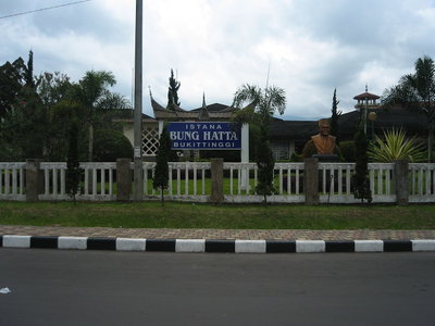
Istana Bung Hatta, Bukittinggi, 2008
Istana Bung Hatta 2008 Istana Bung Hatta in Bukittinggi, West Sumatra, associated with Indonesia's first vice president Mohammad Hatta, who was born in the town, is pictured in this 2008 photograph.
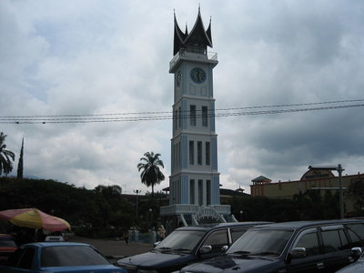
Jam Gadang Bukittinggi, Bukittinggi, 2008
Jam Gadang Bukittinggi 2008 Jam Gadang, the large clock tower at the center of Bukittinggi, West Sumatra, is shown in this 2008 photograph. Built in 1926 during the Dutch colonial period, the tower remains the city's best-known landmark.
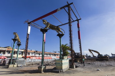
Pasar Atas Bukittinggi (Pasa Ateh Bukittinggi), Bukittinggi, 2018
Pasar Atas Bukittinggi (Pasa Ateh Bukittinggi) 2018 Pasar Atas, the upper market of Bukittinggi in West Sumatra, Indonesia, sits near the town's landmark clock tower, Jam Gadang, and has long served as a center of trade for the surrounding highland region. Photographed in 2018.