Home › Gjirokastër › Kalaja e Gjirokastrës (85230)

Kalaja e Gjirokastrës (85230) through time

Gjirokastër 1913–2025 8 photos of this spot

8 photographs taken at the same spot in Gjirokastër, spanning 1913–2025 — 7 of them from before 1980. Line them up and watch the place change.

A general view of Gjirokastër photographed in 1913 during the Balkan Wars, when control of southern Albania was contested. The hillside town, built largely of stone, is dominated by its historic castle overlooking the valley below.

See this spot on the map
Have an old photo of Kalaja e Gjirokastrës (85230)? A family album, a postcard, a print from the attic. Pin it to the map and it becomes part of the record.
Add your photo
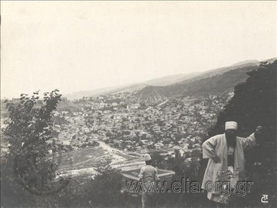
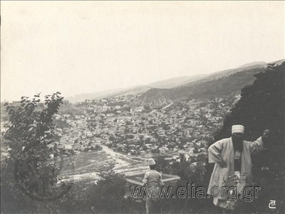
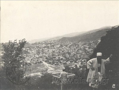
EU: General view of the city, the Balkan Wars (1913), Gjirokastër, 1913
EU: General view of the city, the Balkan Wars (1913) 1913 A general view of Gjirokastër photographed in 1913 during the Balkan Wars, when control of southern Albania was contested. The hillside town, built largely of stone, is dominated by its historic castle overlooking the valley below.
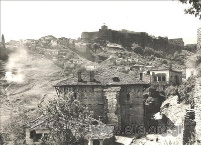
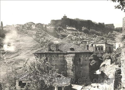
EU: Village and the castle (1913), Gjirokastër, 1913
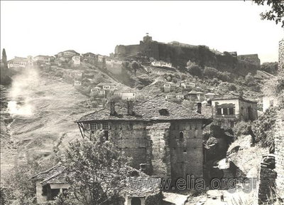
EU: Village and the castle (1913) 1913 Gjirokastër's hillside houses and its historic castle appear together in this 1913 photograph, taken during the Balkan Wars. The fortress has watched over the town and surrounding valley in southern Albania for centuries.
EU: Γενική άποψη της πόλης, Βαλκανικοί Πόλεμοι (1913), Gjirokastër, 1913
EU: Γενική άποψη της πόλης, Βαλκανικοί Πόλεμοι (1913) 1913 This Greek-captioned photograph offers another general view of Gjirokastër taken in 1913 during the Balkan Wars. Stone houses climb the hillside beneath the town's castle, a landmark of southern Albania.
EU: Άποψη του χωριού και του κάστρου (1913), Gjirokastër, 1913
EU: Άποψη του χωριού και του κάστρου (1913) 1913 With a Greek-language caption, this 1913 image shows the village of Gjirokastër alongside its hilltop castle. The Balkan Wars were reshaping the borders of the region at the time the photograph was taken.
EU: Γενική άποψη της πόλης, Βαλκανικοί Πόλεμοι. (1913), Gjirokastër, 1913
EU: Γενική άποψη της πόλης, Βαλκανικοί Πόλεμοι. (1913) 1913 A general view of a town affected by the Balkan Wars is shown in this 1913 photograph taken at Gjirokastër, in present-day Albania, during the conflicts that reshaped the region's borders and drew the town under Albanian sovereignty.
EU: Άποψη του χωριού και του κάστρου. (1913), Gjirokastër, 1913
EU: Άποψη του χωριού και του κάστρου. (1913) 1913 A hillside village and its castle are pictured in this 1913 photograph of Gjirokastër, Albania, home to one of the largest hilltop fortresses in the Balkans, overlooking the stone houses of the old town below.
EU: N.º 27. Gjirokastra o Argirokastro. - Antigua ciudadela (1933), Gjirokastër, 1933
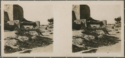
EU: N.º 27. Gjirokastra o Argirokastro. - Antigua ciudadela (1933) 1933 The old citadel of Gjirokastër, the hilltop fortress overlooking this southern Albanian city, is shown in a 1933 photograph. The town's stone-roofed old quarter was later inscribed as a UNESCO World Heritage Site.
Kalaja e Gjirokastrës (85230), Gjirokastër, 2025
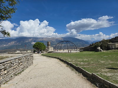
Kalaja e Gjirokastrës (85230) 2025 The hilltop castle of Gjirokastër, Albania, seen in 2025; the fortress overlooks the town's Ottoman-era stone houses in the Drino Valley. Gjirokastër's old bazaar and characteristic stone-roofed houses were inscribed as a UNESCO World Heritage Site in 2005.