Home › Nairobi › Haile Selassie Avenue (Nairobi)

Haile Selassie Avenue (Nairobi) through time

Nairobi 1913–2025 26 photos of this spot

26 photographs taken at the same spot in Nairobi, spanning 1913–2025 — 24 of them from before 1980. Line them up and watch the place change.

Published in Jules Leclercq's 1913 travel account "Aux sources du Nil," this view captures a street in Nairobi alongside the Hotel Norfolk, one of the city's earliest hotels catering to travelers heading into British East Africa.

See this spot on the map
Have an old photo of Haile Selassie Avenue (Nairobi)? A family album, a postcard, a print from the attic. Pin it to the map and it becomes part of the record.
Add your photo
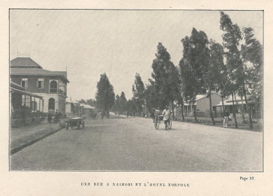
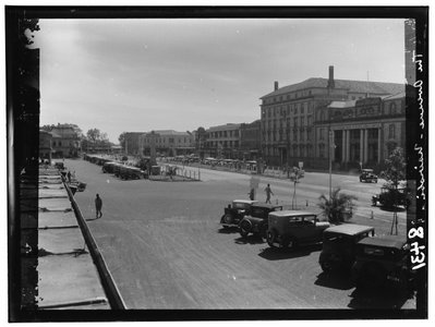
Jules Leclercq- Aux sources du rue de Nairobi & hôtel Norfolk, Nairobi, 1913
Jules Leclercq- Aux sources du rue de Nairobi & hôtel Norfolk 1913 Published in Jules Leclercq's 1913 travel account "Aux sources du Nil," this view captures a street in Nairobi alongside the Hotel Norfolk, one of the city's earliest hotels catering to travelers heading into British East Africa.
EU: Main class in Nairobi (1927), Nairobi, 1927
EU: Main class in Nairobi (1927) 1927 A classroom scene at a school in Nairobi, Kenya, captioned simply 'Main class' and dated to 1927. The image dates from the era of British colonial administration in what was then known as British East Africa.
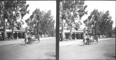
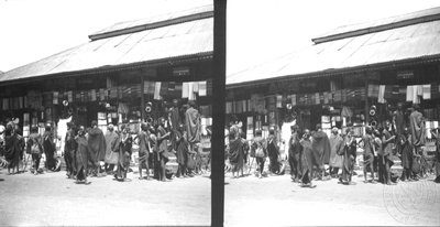
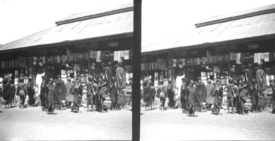
EU: Shops in Nairobi district (1927), Nairobi, 1927
EU: Shops in Nairobi district (1927) 1927 Shops line a street in the Nairobi district in this 1927 image, taken during the early decades of the city's growth as the administrative center of British colonial Kenya.
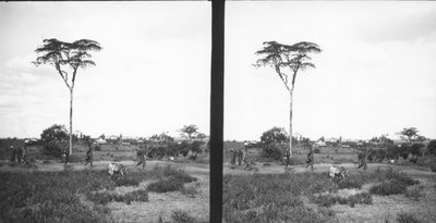
EU: Landscape in the vicinity of Nairobi (1927), Nairobi, 1927
EU: Landscape in the vicinity of Nairobi (1927) 1927 A view of open landscape in the countryside surrounding Nairobi, Kenya, captured in 1927, when the young colonial town was still closely bordered by undeveloped highland terrain.
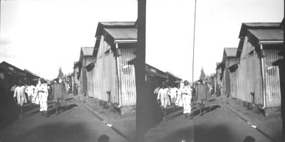
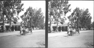
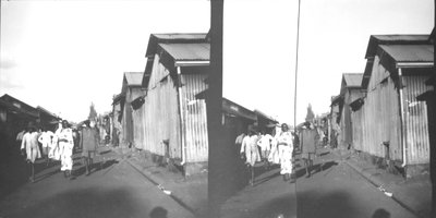
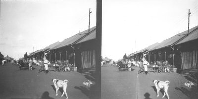
EU: Street in the township of Nairobi (1927), Nairobi, 1927
EU: Street in the township of Nairobi (1927) 1927 A street within the township of Nairobi, Kenya, pictured in 1927 as the settlement expanded outward from its origins as a railway depot founded at the turn of the century.
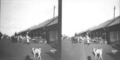
EU: Dog on the street in the township of Nairobi (1927), Nairobi, 1927
EU: Dog on the street in the township of Nairobi (1927) 1927 A dog rests on a street in the township of Nairobi in this 1927 photograph, offering a glimpse of everyday life in the young colonial-era town, which had grown up around a railway depot founded only three decades earlier.
EU: Main class in Nairobi (1930), Nairobi, 1930
EU: Main class in Nairobi (1930) 1930 This 1930 photograph was taken in Nairobi, then a young colonial town in British East Africa that had grown rapidly since its founding as a railway depot three decades earlier.
EU: Shops in Nairobi district (1930), Nairobi, 1930
EU: Shops in Nairobi district (1930) 1930 Shopfronts in a Nairobi district are pictured in this 1930 photograph, from a period when the town was expanding quickly as the administrative center of British East Africa.
EU: Street in the township of Nairobi (1930), Nairobi, 1930
EU: Street in the township of Nairobi (1930) 1930 This 1930 photograph shows a street in one of Nairobi's townships, residential districts that grew up alongside the young colonial capital of British East Africa.
EU: Dog on the street in the township of Nairobi (1930), Nairobi, 1930
EU: Dog on the street in the township of Nairobi (1930) 1930 A dog rests on a street in a Nairobi township in this 1930 photograph, a candid glimpse of everyday life in the colonial-era town.
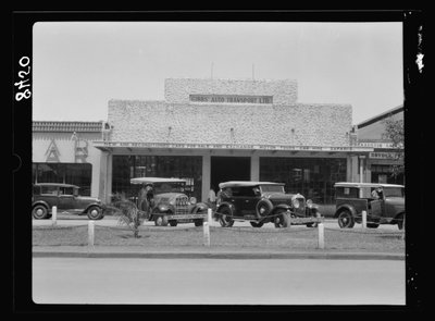
Kenya Colony. Nairobi. Gibbs' Auto Transport Ltd. LOC, Nairobi, 1936
Kenya Colony. Nairobi. Gibbs' Auto Transport Ltd. LOC 1936 Nairobi, capital of Kenya Colony, was home to firms such as Gibbs' Auto Transport Ltd., which served the growing motor traffic connecting the city with the agricultural districts of British East Africa in the 1930s.
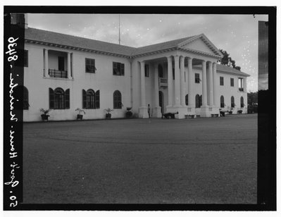
Kenya Colony. Nairobi. Government House LOC, Nairobi, 1936
Kenya Colony. Nairobi. Government House LOC 1936 Government House in Nairobi served as the official residence of the governor of Kenya Colony, the seat from which the British colonial administration governed the territory during the 1930s, when Nairobi had grown into East Africa's principal administrative center.
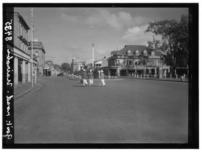
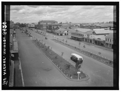
Kenya Colony. Nairobi. Government Road LOC, Nairobi, 1936
Kenya Colony. Nairobi. Government Road LOC 1936 Government Road, later renamed Moi Avenue, ran through the heart of Nairobi and was lined with shops, offices and banks serving Kenya Colony's rapidly growing capital during the interwar decades of British rule.
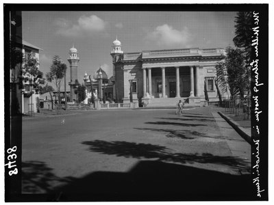
Kenya Colony. Nairobi. MacMillan Library and the Indian mosque LOC, Nairobi, 1936
Kenya Colony. Nairobi. MacMillan Library and the Indian mosque LOC 1936 The MacMillan Memorial Library, which opened in Nairobi in 1931 and was endowed by the American-born settler Sir Northrup MacMillan, stood near an Indian mosque, a pairing that reflected the city's mix of European and South Asian communities under British colonial rule.
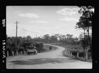
Kenya Colony. Nairobi. Motor highway entering the town LOC, Nairobi, 1936
Kenya Colony. Nairobi. Motor highway entering the town LOC 1936 A motor highway approaching Nairobi illustrates the expanding road network that linked Kenya Colony's capital to its surrounding farmland and townships as automobile traffic increased through the 1930s.
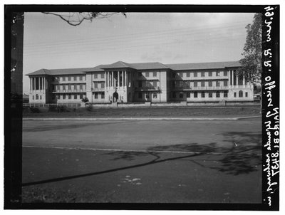
Kenya Colony. Nairobi. Offices of the Uganda-Kenya Railways LOC, Nairobi, 1936
Kenya Colony. Nairobi. Offices of the Uganda-Kenya Railways LOC 1936 These offices in Nairobi housed the administration of the Uganda-Kenya Railways, the rail authority descended from the Uganda Railway whose completion in the early 1900s had first established Nairobi as a depot town and, later, colonial capital.
Kenya Colony. Nairobi. Saddler Street LOC, Nairobi, 1936
Kenya Colony. Nairobi. Saddler Street LOC 1936 Saddler Street formed part of the commercial quarter of Nairobi, capital of Kenya Colony, where small trades and shopfronts served the city's growing settler and immigrant population during the 1930s.
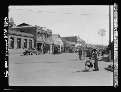
Kenya Colony. Nairobi. Sixth Avenue. Main thoroughfare LOC, Nairobi, 1936
Kenya Colony. Nairobi. Sixth Avenue. Main thoroughfare LOC 1936 Sixth Avenue, later renamed Kenyatta Avenue, was a principal thoroughfare of Nairobi and a center of commerce as the city expanded into the administrative and economic hub of Kenya Colony.
Kenya Colony. Nairobi. Sixth Avenue near the standard bank LOC, Nairobi, 1936
Kenya Colony. Nairobi. Sixth Avenue near the standard bank LOC 1936 This view along Sixth Avenue near a branch of the Standard Bank captures part of Nairobi's commercial district, which grew steadily during the 1930s as Kenya Colony's capital and a center of banking and trade in British East Africa.
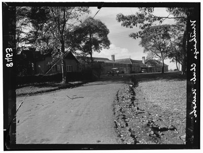
Kenya Colony. Nairobi. The Muthaiga Club, exterior LOC, Nairobi, 1936
Kenya Colony. Nairobi. The Muthaiga Club, exterior LOC 1936 The Muthaiga Club, founded in 1913 as an exclusive social club for Nairobi's European settler community, is shown here at its clubhouse outside the city center, a gathering place long associated with colonial Kenya's elite.
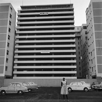
EU: Reportage photograph 25-26/1964: Eero Sauri in Kenya - Nairobi street with Mowlem building (1964), Nairobi, 1964
EU: Reportage photograph 25-26/1964: Eero Sauri in Kenya - Nairobi street with Mowlem building (1964) 1964 Taken during Eero Sauri's 1964 reportage trip to Kenya, this photograph shows a Nairobi street with the Mowlem building, in the years just after the country's independence.
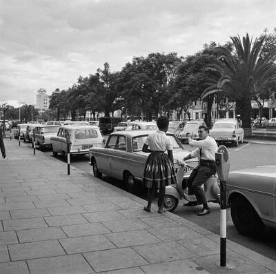
EU: Reportage photograph 25-26/1964: Eero Sauri in Kenya - Nairobi street cars and parking (1964), Nairobi, 1964
EU: Reportage photograph 25-26/1964: Eero Sauri in Kenya - Nairobi street cars and parking (1964) 1964 Another frame from the same 1964 assignment shows cars parked along a Nairobi street, documenting the young capital's growing traffic in the early years after independence.
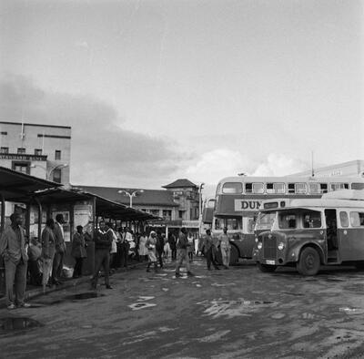
EU: Reportage photograph 25-26/1964: Eero Sauri in Kenya - Nairobi bus station (1964), Nairobi, 1964
EU: Reportage photograph 25-26/1964: Eero Sauri in Kenya - Nairobi bus station (1964) 1964 This 1964 photograph from Eero Sauri's Kenya reportage shows a bus station in Nairobi, part of the city's public transport infrastructure in the early independence era.
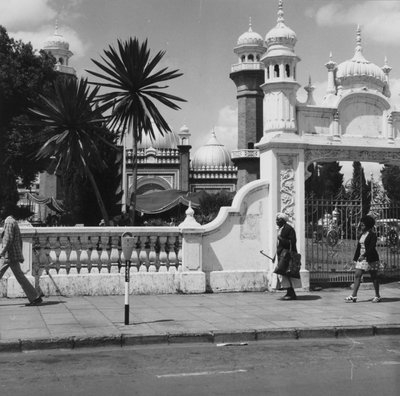
COLLECTIE TROPENMUSEUM De Jamia Moskee in het centrum van Nairobi TMnr, Nairobi, 1973
COLLECTIE TROPENMUSEUM De Jamia Moskee in het centrum van Nairobi TMnr 1973 Jamia Mosque stands in central Nairobi, serving as the city's principal mosque for its Muslim community since the early twentieth century. This 1973 image comes from the Tropenmuseum collection, part of a large Dutch archive documenting life across former colonial territories.
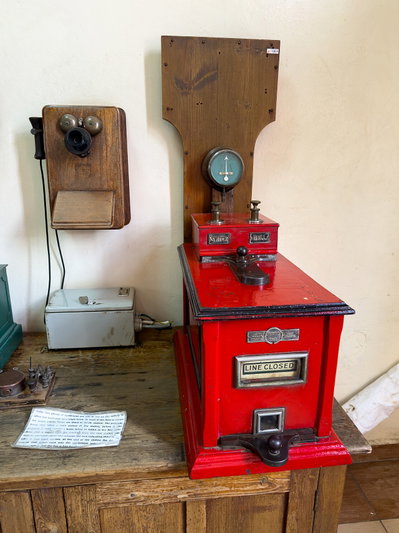
At Nairobi Railway Museum 2025 163, Nairobi, 2025
At Nairobi Railway Museum 2025 163 2025 A second 2025 view inside the Nairobi Railway Museum, whose collection of vintage steam engines and carriages traces the history of rail transport through Kenya since the colonial period.
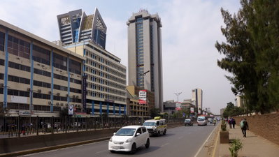
Haile Selassie Avenue (Nairobi), Nairobi, 2025
Haile Selassie Avenue (Nairobi) 2025 Haile Selassie Avenue is a major thoroughfare in downtown Nairobi, Kenya, named after the former Ethiopian emperor. This 2025 photograph shows the street amid the city's dense commercial core.