Home › Reykjavik › Hótel Reykjavik Centrum

Hótel Reykjavik Centrum through time

Reykjavik 1880–2013 35 photos of this spot

35 photographs taken at the same spot in Reykjavik, spanning 1880–2013 — 31 of them from before 1980. Line them up and watch the place change.

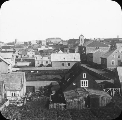
A magic-lantern slide view of Reykjavik, Iceland, from 1880, with the Dómkirkjan cathedral visible to the right, at a time when the town was still a small settlement serving as Iceland's administrative center.

See this spot on the map
Have an old photo of Hótel Reykjavik Centrum? A family album, a postcard, a print from the attic. Pin it to the map and it becomes part of the record.
Add your photo
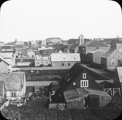
EU: Skioptikonbild. Motiv från Reykjavik, Island med Dómkirkjan till höger. (1880), Reykjavik, 1880
EU: Skioptikonbild. Motiv från Reykjavik, Island med Dómkirkjan till höger. (1880) 1880 A magic-lantern slide view of Reykjavik, Iceland, from 1880, with the Dómkirkjan cathedral visible to the right, at a time when the town was still a small settlement serving as Iceland's administrative center.
EU: Skioptikonbild. Motiv från Reykjavik, Island med Dómkirkjan till höger. (1890), Reykjavik, 1890
EU: Skioptikonbild. Motiv från Reykjavik, Island med Dómkirkjan till höger. (1890) 1890 This 1890 lantern-slide image shows a view of Reykjavik with Dómkirkjan, the cathedral of Iceland, visible to the right. Reykjavik was then a small administrative town on an island still under the Danish crown.
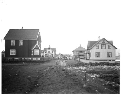
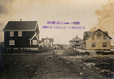
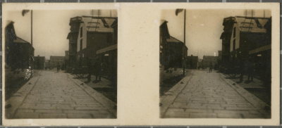
EU: Reykjavik/ Island: Straße in Reykjavik (1912), Reykjavik, 1912
EU: Reykjavik/ Island: Straße in Reykjavik (1912) 1912 A street in Reykjavik photographed in 1912, when Iceland's capital was still a modest town of low wooden and corrugated-iron buildings before its rapid twentieth-century growth.
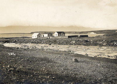
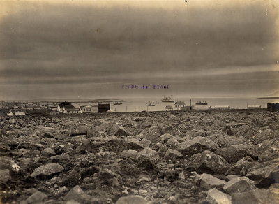
EU: Reykjavík (Island). Küstenlandschaft mit drei Wohnhäusern (1912), Reykjavik, 1912
EU: Reykjavík (Island). Küstenlandschaft mit drei Wohnhäusern (1912) 1912 Three houses stand along the Reykjavik shoreline in this 1912 view, reflecting the small scale of the Icelandic capital before its later expansion into a modern city.
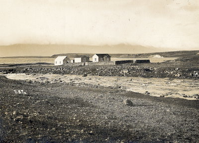
EU: Reykjavik (Island). Küstenlandschaft mit drei Wohnhäusern (1912), Reykjavik, 1912
EU: Reykjavik (Island). Küstenlandschaft mit drei Wohnhäusern (1912) 1912 Another view of the same stretch of Reykjavik coastline in 1912, showing three houses set along the shore during a period when Iceland's capital remained a small town of scattered wooden buildings.
EU: Reykjavík Küstenlandschaft mit drei Wohnhäusern (1912), Reykjavik, 1912
EU: Reykjavík Küstenlandschaft mit drei Wohnhäusern (1912) 1912 A further photograph from 1912 documenting three houses along the Reykjavik waterfront, part of a series recording the modest coastal architecture of Iceland's capital in the early twentieth century.
EU: Reykjavik/ Island: Straße in Reykjavik (1917), Reykjavik, 1917
EU: Reykjavik/ Island: Straße in Reykjavik (1917) 1917 A street in Reykjavik, Iceland, photographed in the early twentieth century when the city was still a small but growing administrative center for the Danish territory, its streets only beginning to see modern development.
EU: Reykjavik/Iceland: Bay with passenger steamer Victoria Luise (1917), Reykjavik, 1917
EU: Reykjavik/Iceland: Bay with passenger steamer Victoria Luise (1917) 1917 The passenger steamer Victoria Luise rides in the bay off Reykjavik, Iceland, one of the vessels that called at the Icelandic capital's harbor in the 1910s, linking the island to ports in Europe.
EU: Reykjavik (1930) - RAA, Reykjavik, 1930
EU: Reykjavik (1930) - RAA 1930 A 1930 photograph of Reykjavik, Iceland, taken while the city was still a relatively small capital, well before its rapid mid-twentieth-century growth.
EU: Reykjavik (1930) - RAA, Reykjavik, 1930
EU: Reykjavik (1930) - RAA 1930 Reykjavik, Iceland, pictured in 1930, a period when the Icelandic capital's population and built-up area were still modest compared with later decades.
EU: Reykjavík látképe (1931), Reykjavik, 1931
EU: Reykjavík látképe (1931) 1931 Captioned in Hungarian as a 'view of Reykjavík,' this 1931 image shows the Icelandic capital from an elevated vantage point, a common format for postcard photography of the era, when the city was still a compact harbour town.
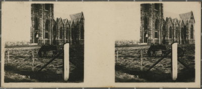
EU: Reykjavík látképe, Landakotskirkja (1931), Reykjavik, 1931
EU: Reykjavík látképe, Landakotskirkja (1931) 1931 A 1931 view of Reykjavík includes Landakotskirkja, completed in 1929 as Iceland's Catholic cathedral and designed in a neo-Gothic style, seen here rising over the surrounding townscape.
EU: No. 153. Reykjavik - Catholic Churchs. (1933), Reykjavik, 1933
EU: No. 153. Reykjavik - Catholic Churchs. (1933) 1933 Numbered 153 in a postcard series, this 1933 photograph shows Reykjavík's Catholic church, Landakotskirkja, completed in 1929 in a neo-Gothic design.
EU: No. 154. Reykjavik - Thermal sources. (1933), Reykjavik, 1933
EU: No. 154. Reykjavik - Thermal sources. (1933) 1933 Numbered 154 in the same postcard series, this 1933 photograph documents thermal springs near Reykjavík, a reminder of the geothermal activity that has long shaped Iceland's landscape.
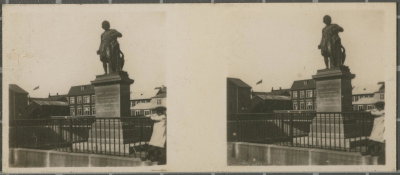
EU: N.º 152 Reykjavik. - Monumento á Thorwaldsen. (1933), Reykjavik, 1933
EU: N.º 152 Reykjavik. - Monumento á Thorwaldsen. (1933) 1933 This 1933 postcard photograph, numbered 152, shows the monument to sculptor Bertel Thorvaldsen standing in Austurvöllur square in central Reykjavík.
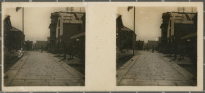
EU: No. 151. Reykjavik. - Entry by the main landing party (1933), Reykjavik, 1933
EU: No. 151. Reykjavik. - Entry by the main landing party (1933) 1933 Numbered 151 in a postcard series produced for visitors in the early 1930s, this 1933 photograph is captioned 'entry by the main landing party,' though further details of the event were not recorded.
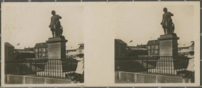
EU: No. 152 Reykjavik. - Monumento á Thorwaldsen. (1933), Reykjavik, 1933
EU: No. 152 Reykjavik. - Monumento á Thorwaldsen. (1933) 1933 A further copy of the numbered postcard view (no. 152) of the Thorvaldsen monument in Reykjavík's Austurvöllur square, photographed in 1933.
EU: No. 151. Reykjavik - Entry by the main landing party (1933), Reykjavik, 1933
EU: No. 151. Reykjavik - Entry by the main landing party (1933) 1933 A duplicate of the numbered postcard view (no. 151) captioned 'entry by the main landing party,' photographed in Reykjavík in 1933 as part of a set produced for visitors.
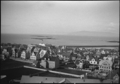
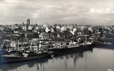
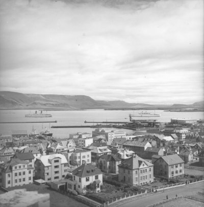
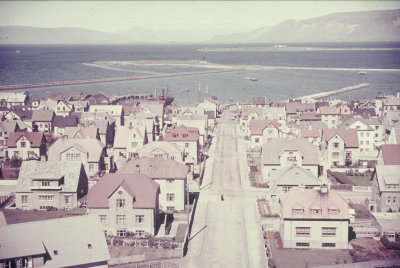
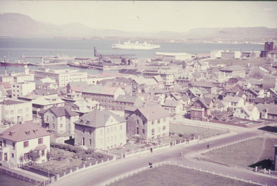
EU: Travel photos Iceland. Reykjavik. Town view with Faxaflói bay (1939), Reykjavik, 1939
EU: Travel photos Iceland. Reykjavik. Town view with Faxaflói bay (1939) 1939 Reykjavik's townscape overlooking Faxaflói bay, photographed in 1939. Iceland's capital was still a relatively small port town at the time, prior to the rapid growth it experienced during and after the Second World War.
EU: Reisefotos Island. Reykjavik. Blick über die Stadt zum Hafen (1939), Reykjavik, 1939
EU: Reisefotos Island. Reykjavik. Blick über die Stadt zum Hafen (1939) 1939 A view over Reykjavik toward its harbor, photographed in 1939. Iceland's capital and its port were the country's principal center of trade and shipping in the years before the Second World War brought major change to the island.
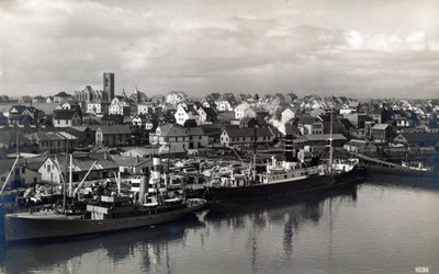
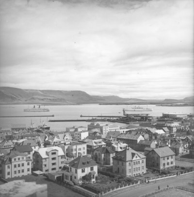
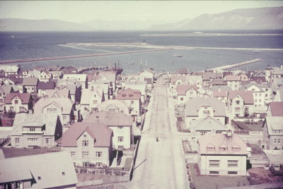
EU: Reykjavik Town view with Faxaflói bay (1939), Reykjavik, 1939
EU: Reykjavik Town view with Faxaflói bay (1939) 1939 Reykjavik's townscape opens onto Faxaflói bay in this 1939 photograph, taken before the wartime growth that transformed the Icelandic capital in the following decade.
EU: Travel photos Iceland. Reykjavik. View across the city to the harbor (1939), Reykjavik, 1939
EU: Travel photos Iceland. Reykjavik. View across the city to the harbor (1939) 1939 A 1939 view across Reykjavik toward its harbor, then a modestly sized fishing town serving as Iceland's capital, years before wartime occupation brought rapid growth to the city.
EU: Reisefotos Island. Reykjavik. Blick zum vor Anker liegenden Passagierschiff "Reliance" (1942), Reykjavik, 1942
EU: Reisefotos Island. Reykjavik. Blick zum vor Anker liegenden Passagierschiff "Reliance" (1942) 1942 The passenger ship Reliance lies at anchor off Reykjavik in this 1942 photograph, taken during the wartime Allied occupation of Iceland, when the harbor saw heavy military traffic.
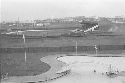
EU: Reykjavik, Utendørs svømmebasseng - 71 (1971), Reykjavik, 1971
EU: Reykjavik, Utendørs svømmebasseng - 71 (1971) 1971 An outdoor swimming pool in Reykjavik, Iceland, photographed on 17 August 1971. Geothermally heated public pools have long been a fixture of everyday life in the Icelandic capital.
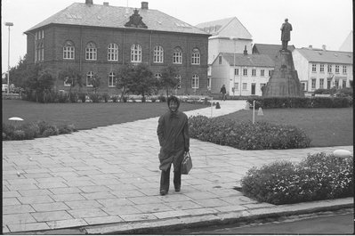
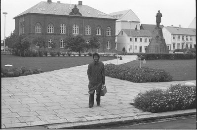
EU: Reykjavik, Alltingshuset (1971) A, Reykjavik, 1971
EU: Reykjavik, Alltingshuset (1971) A 1971 Alþingishúsið, the Parliament House of Iceland in Reykjavik, photographed on 16 August 1971. Completed in 1881, the stone building has housed the Althing, one of the world's oldest surviving legislatures.
EU: Reykjavik, Alltingshuset (1971), Reykjavik, 1971
EU: Reykjavik, Alltingshuset (1971) 1971 A further view of the Parliament House, Alþingishúsið, in Reykjavik from 16 August 1971. The building sits beside Austurvöllur square in the heart of the Icelandic capital.
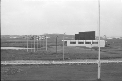
EU: Reykjavik, Nordens hus (1971), Reykjavik, 1971
EU: Reykjavik, Nordens hus (1971) 1971 The Nordic House, Norræna húsið, in Reykjavik, photographed on 17 August 1971. Designed by Finnish architect Alvar Aalto and opened in 1968, the building promotes cultural cooperation among the Nordic countries.
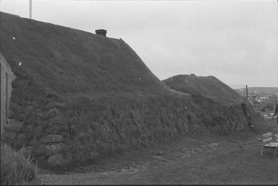
EU: Reykjavik. Folkemuseet på Árbær. - 71 (1971), Reykjavik, 1971
EU: Reykjavik. Folkemuseet på Árbær. - 71 (1971) 1971 The open-air folk museum at Árbær, Árbæjarsafn, on the outskirts of Reykjavik, photographed on 17 August 1971. The museum preserves relocated historic buildings that illustrate traditional Icelandic architecture.
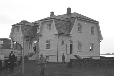
EU: Reykjavik. Høfdi, byens representasjonshus - 71 (1971), Reykjavik, 1971
EU: Reykjavik. Høfdi, byens representasjonshus - 71 (1971) 1971 Höfði, the house used by the City of Reykjavik for official receptions, photographed on 17 August 1971. Built in 1909, the white wooden villa overlooking the sea later became known internationally as the site of a 1986 superpower summit.
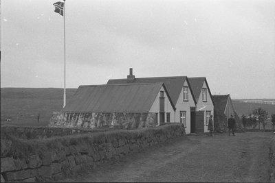
EU: Reykjavik, Folkemuseet på Árbær. Orginalt gårdsmiljø på stedet - 71 (1971), Reykjavik, 1971
EU: Reykjavik, Folkemuseet på Árbær. Orginalt gårdsmiljø på stedet - 71 (1971) 1971 An original farmstead setting preserved at the Árbær open-air museum in Reykjavik, photographed on 17 August 1971. Unlike the museum's relocated buildings, this farm environment stands on its original site.
EU: Reykjavik, Utendørs svømmebasseng (1971), Reykjavik, 1971
EU: Reykjavik, Utendørs svømmebasseng (1971) 1971 Another view of an outdoor swimming pool in Reykjavik, taken in 1971. The Icelandic capital's public pools are heated using the country's abundant geothermal energy.
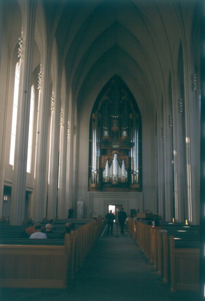
EU: Reykjavik. Hallgrims Church (Hallgrímskirkja) (1937/1943, Weihe 1986; G. Samúelsson). View through the nave towards the organ (1992; Johannes Klais Orgelbau) (1992), Reykjavik, 1992
EU: Reykjavik. Hallgrims Church (Hallgrímskirkja) (1937/1943, Weihe 1986; G. Samúelsson). View through the nave towards the organ (1992; Johannes Klais Orgelbau) (1992) 1992 The nave of Hallgrimskirkja in Reykjavik is seen looking toward its organ in this 1992 photograph. Designed by architect Gudjon Samuelsson and consecrated in 1986, the church acquired the pipe organ, built by the German firm Johannes Klais Orgelbau, that same year.
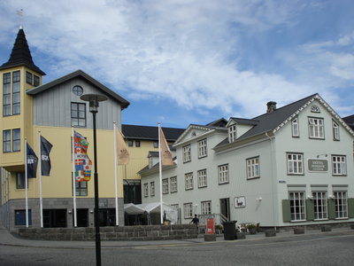
Hótel Reykjavik Centrum, Reykjavik, 2007
Hótel Reykjavik Centrum 2007 Hótel Reykjavík Centrum in central Reykjavik, Iceland, built over remains of the city's early settlement uncovered during construction. Excavated Viking-age foundations beneath the site are now displayed to the public nearby.
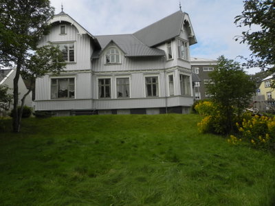
Reykjavik, Reykjavik, 2010
Reykjavik 2010 A view of Reykjavik, Iceland's capital and the northernmost capital city in the world, known for its colorful low-rise buildings and harborside setting.
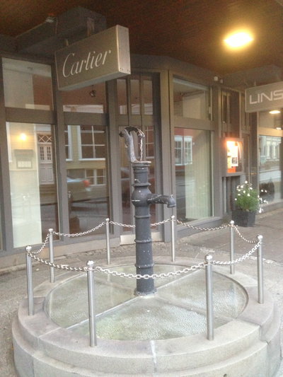
Artaĵo apud butiko Cartier en Rejkjaviko, Reykjavik, 2013
Artaĵo apud butiko Cartier en Rejkjaviko 2013 A public artwork stands beside a Cartier storefront in central Reykjavik, Iceland's capital and the northernmost national capital in the world, photographed in 2013.