Home › Sekondi-Takoradi › Village of Takoradi

Village of Takoradi through time

Sekondi-Takoradi 1920–2022 3 photos of this spot

3 photographs taken at the same spot in Sekondi-Takoradi, spanning 1920–2022 — 1 of them from before 1980. Line them up and watch the place change.

Taken in 1920, this photograph shows Takoradi as a small coastal settlement in the years before construction of Ghana's first deep-water harbor there, a project that later transformed the town into a major port and the twin city of Sekondi-Takoradi.

See this spot on the map
Have an old photo of Village of Takoradi? A family album, a postcard, a print from the attic. Pin it to the map and it becomes part of the record.
Add your photo
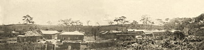
Village of Takoradi, Sekondi-Takoradi, 1920
Village of Takoradi 1920 Taken in 1920, this photograph shows Takoradi as a small coastal settlement in the years before construction of Ghana's first deep-water harbor there, a project that later transformed the town into a major port and the twin city of Sekondi-Takoradi.
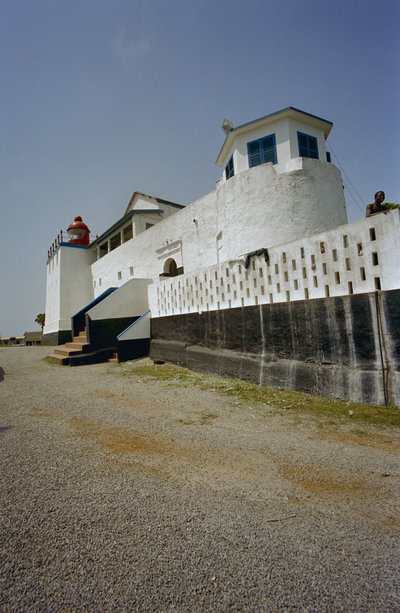
Overzicht voorgevel - Sekondi - - RCE, Sekondi-Takoradi, 2000
Overzicht voorgevel - Sekondi - - RCE 2000 Part of the same year-2000 Dutch heritage survey, this photograph, RCE image 20375138, records a building facade in Sekondi, twin city of Sekondi-Takoradi, near Ghana's first deep-water harbor on the country's coast.
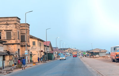
Residential houses in Secondi Takoradi ̠ 2, Sekondi-Takoradi, 2022
Residential houses in Secondi Takoradi ̠ 2 2022 Houses line a residential street in Sekondi-Takoradi, the twin city on Ghana's Gulf of Guinea coast and capital of the Western Region, photographed in 2022. Grown around its port and rail links, Sekondi-Takoradi today ranks among Ghana's largest urban centers.