Home › Cities › Shama

Old photos of Shama

6 photographs of Shama, from 1966 to 2000 — each pinned to the exact place it was taken.

Have an old photo of Shama? A family album, a postcard, a print from the attic. Pin it to the map and it becomes part of the record.
Add your photo

What the photos show

The 6 photographs of Shama on PlaceWas span 2 decades, from 1966 to 2000. 3 of them were taken before 1980; the other 3 are recent views of the same streets and landmarks.1 spot was photographed more than once, so you can compare the same street, square or building across the years.6 of the photos carry a written caption explaining what is in the frame. Every picture is pinned to the place it was taken, so the map below shows where the photographers stood.

Pick a decade to filter the photos below and the map above. Open full map ↗

Places in Shama through time

Spots photographed more than once — compare the same place across the years.
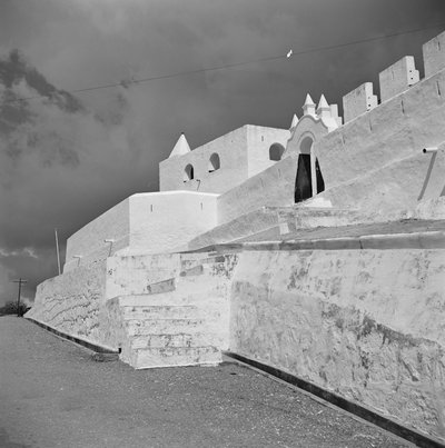
EU: Overzicht met zuidoostgevel kerk (2000), Shama — photos through time
EU: Overzicht met zuidoostgevel kerk (2000) 6 photos · 1966–2000

Stories from Shama

What contributors wrote about these photographs.
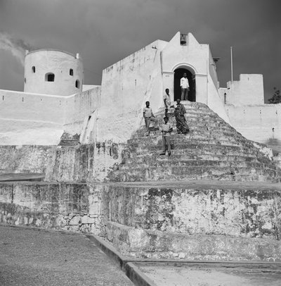
EU: Fort St. Sebastian, hoofdingang zuidzijde (1966), Shama, 1966
EU: Fort St. Sebastian, hoofdingang zuidzijde (1966) 1966 The south-facing main entrance of the fort at Shama, Ghana, one of the oldest European fortifications on the Gold Coast, pictured in 1966. Its position near the mouth of the Pra river made it a valued outpost for coastal…
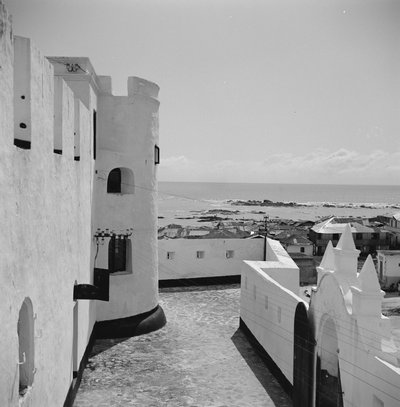
EU: Fort St. Sebastian, westflank (1966), Shama, 1966
EU: Fort St. Sebastian, westflank (1966) 1966 The western flank of the fort at Shama, Ghana, photographed in 1966. Portuguese traders built an early fort here before Dutch forces later took control of the site, making it one of the region's older fortified trading…
EU: Fort St. Sebastian, westzijde (1966), Shama, 1966
EU: Fort St. Sebastian, westzijde (1966) 1966 The west side of the fort at Shama, Ghana, seen in this 1966 photograph of the historic coastal stronghold, which changed hands between European powers before eventually falling under Dutch control.
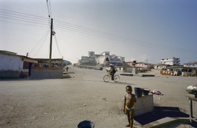
EU: Overzicht voorgevel met omgeving (2000), Shama, 2000
EU: Overzicht voorgevel met omgeving (2000) 2000 The fort at Shama, on Ghana's coast near the mouth of the Pra River, photographed in 2000. The image shows the building's front facade and its immediate surroundings.
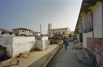
EU: Overzicht met zuidoostgevel kerk (2000), Shama, 2000
EU: Overzicht met zuidoostgevel kerk (2000) 2000 A church at Shama, Ghana, seen from the southeast in this 2000 photograph. Shama's fort and settlement trace back to early European trading posts on the Gold Coast.
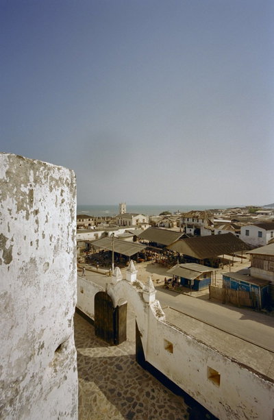
EU: Overzicht vanaf fort met toegangspoortje aan de voorzijde (2000), Shama, 2000
EU: Overzicht vanaf fort met toegangspoortje aan de voorzijde (2000) 2000 The small entrance gateway of the fort at Shama, Ghana, photographed from within the grounds in 2000.
1960s · 3 photos
2000s · 3 photos