Home › Surabaya › Gedung Algemeene

Gedung Algemeene through time

Surabaya 1880–2025 5 photos of this spot

5 photographs taken at the same spot in Surabaya, spanning 1880–2025 — 2 of them from before 1980. Line them up and watch the place change.

Willemskade and the Kampong Baroe district line the Kali Mas river in Surabaya in this 1880 photograph, showing the waterway that served as the city's commercial artery and helped make Surabaya one of the busiest ports in the Dutch East Indies.

See this spot on the map
Have an old photo of Gedung Algemeene? A family album, a postcard, a print from the attic. Pin it to the map and it becomes part of the record.
Add your photo
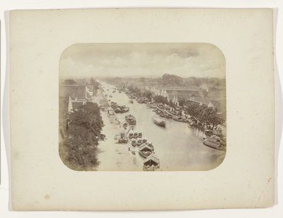
EU: Willemskade en Kampong Baroe langs de Kali Mas te Soerabaja (1880), Surabaya, 1880
EU: Willemskade en Kampong Baroe langs de Kali Mas te Soerabaja (1880) 1880 Willemskade and the Kampong Baroe district line the Kali Mas river in Surabaya in this 1880 photograph, showing the waterway that served as the city's commercial artery and helped make Surabaya one of the busiest ports in the Dutch East Indies.
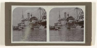
EU: Reede van Surabaya (1917), Surabaya, 1917
EU: Reede van Surabaya (1917) 1917 Ships lie at the roadstead off Surabaya, on the island of Java in the Dutch East Indies, a major port for maritime trade in the region and one of the busiest harbors in the Indonesian archipelago.
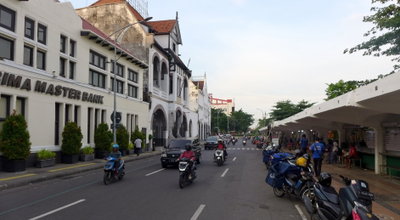
Jalan Jembatan Merah, Surabaya, 2025
Jalan Jembatan Merah 2025 Jalan Jembatan Merah, or Red Bridge Street, in Surabaya, Indonesia, photographed in 2025; the thoroughfare was a major commercial artery during the city's Dutch colonial era.
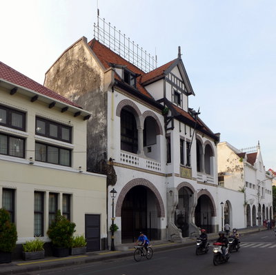
Gedung Algemeene, Surabaya, 2025
Gedung Algemeene 2025 The former Algemeene company building in Surabaya, Indonesia, one of the Dutch-era structures in the city's old commercial quarter, photographed in 2025.
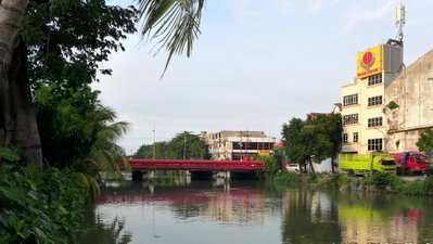
Red Bridge, Surabaya, Surabaya, 2025
Red Bridge, Surabaya 2025 The Red Bridge, or Jembatan Merah, in Surabaya, Indonesia, photographed in 2025; the crossing gives its name to the surrounding historic commercial district.