Home › Hue › Aerial view hoang thanh hue

Aerial view hoang thanh hue through time

Hue 1932–2024 3 photos of this spot

3 photographs taken at the same spot in Hue, spanning 1932–2024 — 2 of them from before 1980. Line them up and watch the place change.

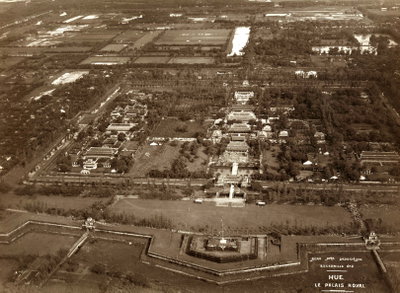
An aerial view of Hué's Imperial City, the walled citadel built by the Nguyen dynasty as the seat of Vietnam's emperors, captured in 1932 while the country remained under French colonial rule.

See this spot on the map
Have an old photo of Aerial view hoang thanh hue? A family album, a postcard, a print from the attic. Pin it to the map and it becomes part of the record.
Add your photo
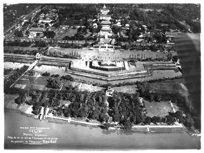
Hué, 1932 – La Ville Impériale – Vue aérienne-2, Hue, 1932
Hué, 1932 – La Ville Impériale – Vue aérienne-2 1932 An aerial view of Hué's Imperial City, the walled citadel built by the Nguyen dynasty as the seat of Vietnam's emperors, captured in 1932 while the country remained under French colonial rule.
Hué, 1932 – La Ville Impériale – Vue aérienne, Hue, 1932
Hué, 1932 – La Ville Impériale – Vue aérienne 1932 A second aerial photograph of Hué's Imperial Citadel from 1932, showing the moated enclosure that once housed the Nguyen dynasty's royal court and government offices within its high brick walls.
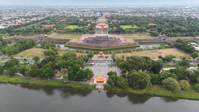
Aerial view hoang thanh hue, Hue, 2024
Aerial view hoang thanh hue 2024 An aerial view of the Imperial City in Hue, photographed in 2024. The walled citadel housed the Nguyen dynasty's royal court and remains the historic heart of the former imperial capital.