Home › Sa Pa › Ham Rong, Ta Phin, QL.4D.Sa Pa, rice fields (23517)

Ham Rong, Ta Phin, QL.4D.Sa Pa, rice fields (23517) through time

Sa Pa 2025 2 photos of this spot

2 recent photographs taken at the same spot in Sa Pa, spanning 2025. Have an older picture of it? Add it and start this spot's timeline.

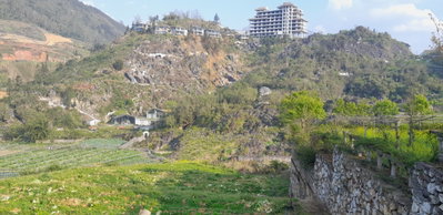
Layered rice paddies near Ta Phin village, within the Sa Pa district of Lao Cai province, follow the contours of the surrounding hills. The area lies along National Road 4D, close to the Ham Rong mountain park above Sa Pa town.

See this spot on the map
Have an old photo of Ham Rong, Ta Phin, QL.4D.Sa Pa, rice fields (23517)? A family album, a postcard, a print from the attic. Pin it to the map and it becomes part of the record.
Add your photo
Ham Rong, Ta Phin, QL.4D.Sa Pa, rice fields (23517), Sa Pa, 2025
Ham Rong, Ta Phin, QL.4D.Sa Pa, rice fields (23517) 2025 Layered rice paddies near Ta Phin village, within the Sa Pa district of Lao Cai province, follow the contours of the surrounding hills. The area lies along National Road 4D, close to the Ham Rong mountain park above Sa Pa town.
Ham Rong, Ta Phin, QL.4D.Sa Pa, rice fields (47027), Sa Pa, 2025
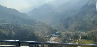
Ham Rong, Ta Phin, QL.4D.Sa Pa, rice fields (47027) 2025 This photograph captures terraced farmland near Ta Phin, a village known for its Red Dao and Hmong communities a short distance from Sa Pa. Such stepped paddies are a defining feature of the agricultural landscape throughout Vietnam's northern mountain districts.