Home › Da Lat › Hồ Xuân Hương

Hồ Xuân Hương through time

Da Lat 1930–2025 5 photos of this spot

5 photographs taken at the same spot in Da Lat, spanning 1930–2025 — 1 of them from before 1980. Line them up and watch the place change.

An aerial view of Da Lat, Vietnam, taken in 1930. The hill town in Vietnam's Central Highlands was developed by the French as a highland retreat in the early twentieth century.

See this spot on the map
Have an old photo of Hồ Xuân Hương? A family album, a postcard, a print from the attic. Pin it to the map and it becomes part of the record.
Add your photo
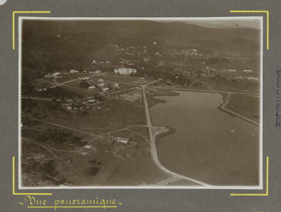
Vue aérienne de Da Lat (11088), Da Lat, 1930
Vue aérienne de Da Lat (11088) 1930 An aerial view of Da Lat, Vietnam, taken in 1930. The hill town in Vietnam's Central Highlands was developed by the French as a highland retreat in the early twentieth century.
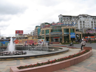
Phường 1, Dalat, Lâm Đồng, Vietnam, Da Lat, 2011
Phường 1, Dalat, Lâm Đồng, Vietnam 2011 A second 2011 view of Ward 1 in Da Lat, the hill station in Vietnam's Central Highlands founded as a French colonial retreat.
Hồ Xuân Hương, Đà Lạt, Da Lat, 2012
Hồ Xuân Hương, Đà Lạt 2012 Xuan Huong Lake forms the centerpiece of Da Lat, Vietnam, an artificial lake created in the 1930s during the French colonial period that remains a focal point of the hill town. Photographed in 2012.
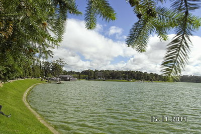
Hồ Xuân Hương, Da Lat, 2014
Hồ Xuân Hương 2014 Xuan Huong Lake in Da Lat, an artificial lake created in 1919 during the French colonial era that remains the town's central landmark.
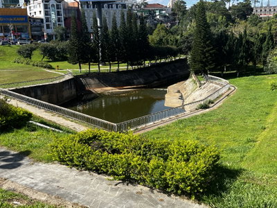
Xuan Huong Lake’s dam, Da Lat, 2025
Xuan Huong Lake’s dam 2025 This 2025 photograph shows the dam at Xuan Huong Lake in Da Lat, Vietnam, an artificial lake created in the 1920s at the center of the hill town founded as a French colonial-era retreat, prized for its cool climate at an elevation of around 1,500 meters.