Home › Sa Pa › Sapa Panorama

Sapa Panorama through time

Sa Pa 1919–2025 16 photos of this spot

16 photographs taken at the same spot in Sa Pa, spanning 1919–2025 — 2 of them from before 1980. Line them up and watch the place change.

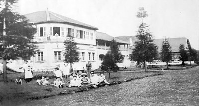
This villa in Sa Pa was built by French colonial authorities in 1919 to house non-commissioned officers stationed at the hill station, and is preserved today as part of a local museum.

See this spot on the map
Have an old photo of Sapa Panorama? A family album, a postcard, a print from the attic. Pin it to the map and it becomes part of the record.
Add your photo
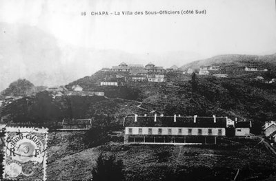
11 19 Vietnam SaPa Museum Villa of the NCOs, Sa Pa, 1919
11 19 Vietnam SaPa Museum Villa of the NCOs 1919 This villa in Sa Pa was built by French colonial authorities in 1919 to house non-commissioned officers stationed at the hill station, and is preserved today as part of a local museum.
11 19 Vietnam SaPa Museum officers Villa, Sa Pa, 1919
11 19 Vietnam SaPa Museum officers Villa 1919 A companion officers' villa in Sa Pa dating to 1919, part of the French colonial garrison architecture now preserved at the town's museum site.
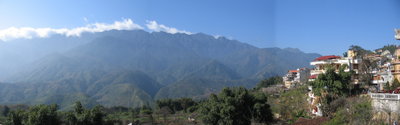
Sapa Panorama, Sa Pa, 2005
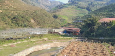
Sapa Panorama 2005 A panoramic view of Sa Pa, a hill town in Vietnam's Lào Cai Province near the Chinese border, photographed in 2005. The area is known for its terraced rice fields and mountain scenery in the Hoàng Liên Son range.
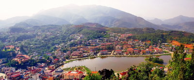
Thị trấn Sa Pa, Sa Pa, 2010
Thị trấn Sa Pa 2010 The town of Sa Pa, Vietnam, in 2010. Set in the mountains of Lào Cai Province, Sa Pa developed as a hill station and remains known for its terraced landscape and ethnic minority communities.
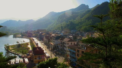
Thi tran Sapa,Lao cai, vietnam, Sa Pa, 2012
Thi tran Sapa,Lao cai, vietnam 2012 The mountain town of Sa Pa, in Vietnam's Lao Cai province, is pictured here in 2012, set among the terraced hillsides of the northern highlands near the border with China.
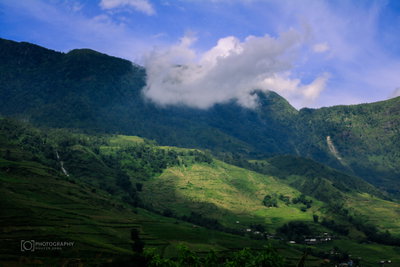
Sapa Panorama in 2017, Sa Pa, 2017
Sapa Panorama in 2017 2017 Cloud drifts over a green, terraced mountain valley near Sa Pa, Vietnam. The town, set in the northern highlands, is known for steep rice terraces cultivated by local ethnic minority communities.
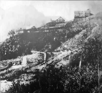
11 19 Vietnam SaPa Museum - trai Hut, Sa Pa, 2017
11 19 Vietnam SaPa Museum - trai Hut 2017 This 2017 photograph shows a museum display in Sa Pa depicting the town's Trai Hut area in the early 20th century. Sa Pa, in Vietnam's mountainous Lao Cai province, developed as a hill station during the French colonial period.
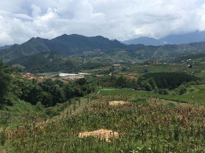
Landscape in Sa Pa 6, Sa Pa, 2018
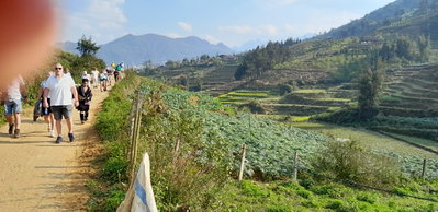
Landscape in Sa Pa 6 2018 Terraced fields fall away across a mountain valley near Sa Pa, in Vietnam's Lao Cai Province, where farming on steep slopes has shaped the landscape for generations. Photographed in 2018.
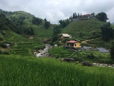
Stream in Lao Chải 2, Sa Pa, 2018
Stream in Lao Chải 2 2018 A stream runs through Lao Chai, a village in the Muong Hoa valley near Sa Pa in northern Vietnam, an area home to Hmong and Dao ethnic minority communities amid terraced rice fields. Photographed in 2018.
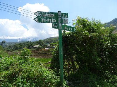
Road sign in Sa Pa, Sa Pa, 2018
Road sign in Sa Pa 2018 A road sign in Sa Pa points travelers through this mountain town in northern Vietnam, developed by the French in the early twentieth century as a cool-climate hill station near the Chinese border.
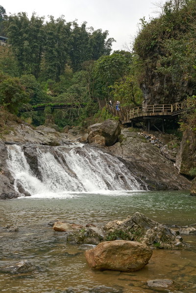
Cat Cat Waterfalls, Sa Pa, Vietnam, 1244, Sa Pa, 2024
Cat Cat Waterfalls, Sa Pa, Vietnam, 1244 2024 The Cat Cat waterfalls near Sa Pa, a hill town in northern Vietnam's Lào Cai province known for its mountain scenery and ethnic minority villages, sit within a valley long inhabited by the Hmong community.
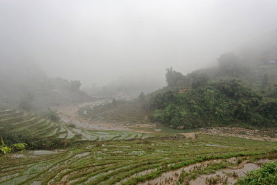
Paddy fields in Lào Cai, Sa Pa, Vietnam, 1049, Sa Pa, 2024
Paddy fields in Lào Cai, Sa Pa, Vietnam, 1049 2024 Terraced rice paddies near Sa Pa in Lào Cai province, part of the mountainous farmland cultivated for generations by the region's ethnic minority communities on the slopes surrounding the town.
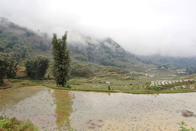
Paddy fields near Sa Pa, Vietnam, 1152, Sa Pa, 2024
Paddy fields near Sa Pa, Vietnam, 1152 2024 Rice paddies climb the hillsides near Sa Pa in northern Vietnam's Lào Cai province, a landscape shaped by generations of terraced farming in a region bordering China's Yunnan province.
Ham Rong, Ta Phin, QL.4D.Sa Pa, rice fields (47118), Sa Pa, 2025
Ham Rong, Ta Phin, QL.4D.Sa Pa, rice fields (47118) 2025 Rice terraces cut into the hillsides near Ta Phin, close to Sa Pa in northern Vietnam's Lao Cai province, are visible in this photograph. The Ham Rong massif overlooking Sa Pa town forms part of the same mountainous landscape.
Ham Rong, Ta Phin, QL.4D.Sa Pa, rice fields (93086), Sa Pa, 2025
Ham Rong, Ta Phin, QL.4D.Sa Pa, rice fields (93086) 2025 Near Sa Pa, the hillsides around Ta Phin village are shaped into rice terraces cultivated by ethnic minority farmers for generations. The Ham Rong mountain, a popular viewpoint above Sa Pa town, overlooks this stretch of farmland.
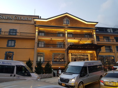
Sapa Charm hotel Vietnam, Sa Pa, 2025
Sapa Charm hotel Vietnam 2025 This 2025 photograph shows the Sapa Charm hotel in the town of Sa Pa, a former French colonial hill station in Vietnam's Lao Cai province now popular as a base for visiting the surrounding terraced valleys.